Using Free DEM for Coverage Prediction in Atoll
Some of us might be familiar with Forsk Atoll, one of the popular RF Simulation software. Creating the sitelist is easy. Creating the cell list easy. Importing the antenna data also easy. But what about the digital map?
Yes, digital map can be hard to obtain. In some case, it cost us at very high price. What if we just need some simple elevation map? Or we just a bunch of students need to do some simulation? Well, in this post I would like to share how to get the elevation map/DEM by the help of USGS Earth Explorer.
We need some tools, such as:
-
USGS Earth Explorer : http://earthexplorer.usgs.gov
-
Global Mapper
-
Forsk Atoll itself
Let’s say we have a new BTS located in Oksibil. Oksibil is a district in Papua, Indonesia. Located close to the border of Papua New Guinea.
The coordinates is Long=140.627113 Lat=-4.907210. Antenna used is GSM 11 dBi at height 36 meter above the ground.
Okay let start the session!
GETTING ASTER GLOBAL DEM DATA
Go to http://earthexplorer.usgs.gov using your browser. Register first before you continue the steps.
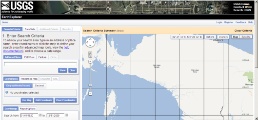
To make it easier when selecting the area, first you need to put where is the BTS location. Click anywhere on the map screen. You will find one placemark indicated with “1″.
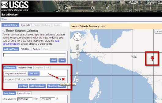
Then on the left screen choose Decimal and Edit to change the coordinates as the BTS coordinate.
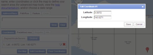
Change the coordinate and click Save. The placemark will move to the BTS coordinate.
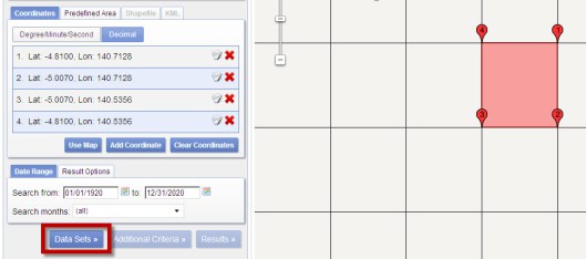
After that, click 2 or 3 times at the zoom control [+] to zoom the area closer. Create a rectangle by clicking the map 4 times. So that you have something like this:
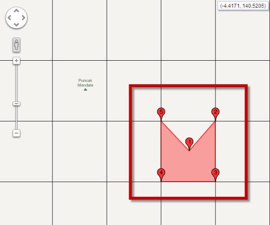
Look at the left pane, and delete the first item in the Coordinates. So you’re going to have 4 points as a Rectangle.
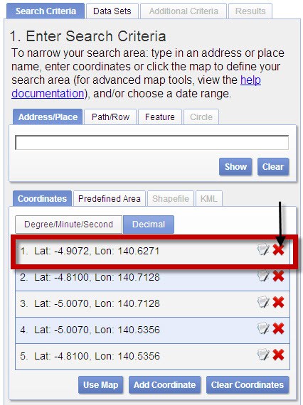
Look at the left corner of the screen, you will see Datasets. Click it.
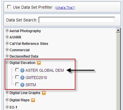
Choose Digital Elevation -> ASTER GLOBAL DEM. Just choose OK if a pop up shown.
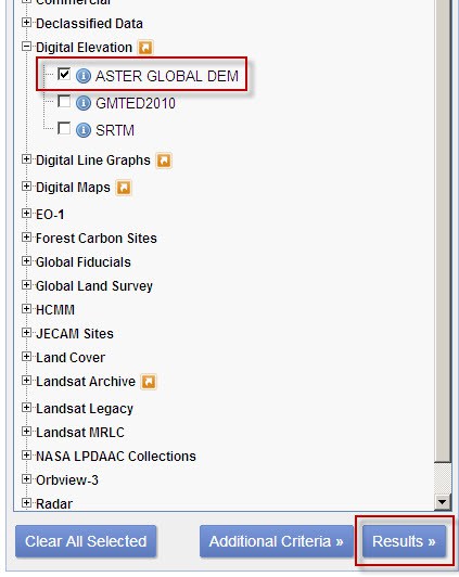
After checked at ASTER GLOBAL DEM, click on Results.
Earth Explorer will process the request. After the process finished, you will see the result. Click on the image icon to check which item should be downloaded.
For example in this result, we use the second result that match with the selection.
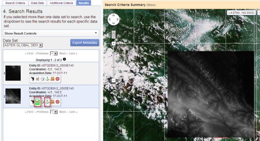
Then,just click the Download button.
Check the Agree box and DOWNLOAD.
One ASTER rectangle is around 18MB, it has 30 m resolution.
USING GLOBAL MAPPER
Open your Global Mapper software and locate the exctracted data.

Choose the xxx_dem. Global Mapper will load the map.

Go to menu Tools -> Configure…
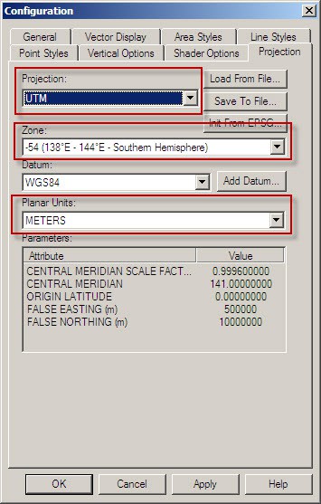
Make sure you choose:
- Projection = UTM
- Zone = will be automatically assigned by Global Mapper,remember this setting (in this example = WGS84 54 S)
- Datum = WGS 84
- Planar unit = meters
Now we need to export this map so we can use it in Atoll.
Go to File -> Export Raster and Elevation Data -> Export Vertical Mapper Grid file.
Click on Click Here to Calculate Spacing in Other Units…
Fill 30 in Long/Lat spacing then OK.
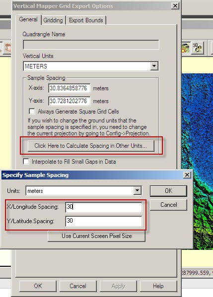
Then OK again. Locate where you want to save the GRD file. Globalmapper will process your file.
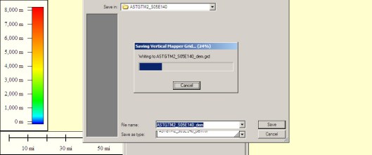
Finish.
OPEN THE DTM IN ATOLL
Open your Forsk Atoll software. Create a new file : File ->New -> From a Document Template…
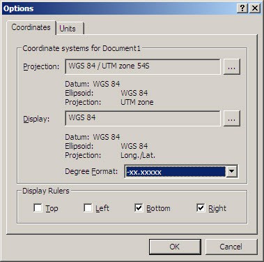
Choose Tools -> Options…
Projection = same projection assigned by Globalmapper (in this example WGS84 / UTM Zone 54S
Display = WGS 84 (Long/Lat)
Degree Format = -xx.xxxxx
Go to File -> Import…
Locate the exported data(*.GRD).Then click Open.

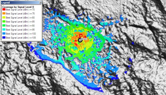
The map will be opened in Atoll. Now you can do the job as usual. This is the result example:
Give it a try, just let me know if you face any problem at email.


